
The Humanitarian Information Unit (HIU) has released several new datasets that leverage the Office of the Geographer‘s work on mapping International Boundaries. The Large Scale International Boundaries (LSIB) dataset, maintained by the Geographic Information Unit (GIU), is a vector line file that is believed to be the most accurate worldwide (non-Europe, non-US) international boundary vector line file available. The lines reflect U.S. government (USG) policy and thus not necessarily de facto control (cited from metadata attached to files). In September 2011, the HIU first released the boundaries publicly for download. Working with colleagues at DevelopmentSeed after that release, they made some substantial improvements to the underlying data structure that helped lead to this work.
The LSIB dataset is designed for cartographic representation and map production. However, this poses a problem for GIS analysis, because the dataset is only composed of vector lines of terrestrial boundaries between countries. This means they do not contain coastlines, and could not be converted into polygons for GIS analysis. To address this issue, the HIU combined the LSIB dataset with the World Vector Shorelines (1:250,000) dataset. The combination of these two datasets is one of the highest resolution country polygon datasets available. Additionally, the LSIB-WVS polygon file is believed to be the most accurate available dataset for determining island sovereignty. It corrects the numerous island sovereignty mistakes in the original WVS data (cited from metadata attached to files).
Two other modifications were made to the datasets. First, the large cartographic scale of the data also introduces a problem in that the data are too detailed for global scale mapping. Therefore, the HIU also created “generalized” versions of the original LSIB-WVS polygons that are suitable for smaller scale mapping. Second, in order to facilitate the ability to “join” data to the polygons in a GIS, several attributes were added to the database, including Country Name and several ISO 3166-1 Country Codes (ISO Alpha 2, ISO Alpha 3, and ISO Number). After a year of work, the data have been released into the public domain.
All datasets can be downloaded from the HIU Data page or the links below:
LSIB – WVS Country Polygons
High Resolution LSIB-WVS Country Polygons (Americas) :: https://hiu.state.gov/data/Americas_LSIBPolygons_2013March08_HIU_USDoS.zip
High Resolution LSIB-WVS Country Polygons (Africa/Eurasia) :: https://hiu.state.gov/data/EurasiaAfrica_LSIBPolygons_2013March08_HIU_USDoS.zip
Simplified Versions
Simplified Global World Vector Shorelines :: https://hiu.state.gov/data/Global_SimplifiedShoreline_2013March08_HIU_USDoS.zip
Simplified Global Country Polygons :: https://hiu.state.gov/data/Global_LSIBSimplifiedPolygons_2013March08_HIU_USDoS.zip
LSIB Lines
Large Scale International Boundaries (LSIB), AFRICA and the AMERICAS :: https://hiu.state.gov/data/AFRICAandAMERICAS_LSIB4b_2012Sep04_USDoS_HIU.zip
Large Scale International Boundaries (LSIB), EURASIA :: https://hiu.state.gov/data/EURASIA_LSIB4b_2012Sep04_USDoS_HIU.zip
Cartographic Guidance
Note, both the polygon and line datasets are useful for cartographic representation. This is due to the variety of different boundary classifications that are in the LSIB. Below is a subset from the metadata attached to the datasets that describes USG cartographic representation of the boundary lines.
From the LSIB lines metadata:
The “Label” attribute field provides a name for any line requiring non-standard depiction, such as “1949 Armistice Line” or “DMZ”
The “Rank” attribute categorizes lines into one of three categories:
a) A rank of “1” (includes most of the 320 international boundaries) for those which the USG considers “full international boundaries.”
b) A rank of “3” for other lines of international separation. Most are considered by the US government to be in dispute.
c) A rank of “7” for other lines of separation such as DMZ’s, No-Mans Land (Israel), UNDOF zone lines (Golan Hts.), Sudan’s Abyei, and for the US Naval Base Guantanamo Bay on Cuba.
Any line with a rank of “3” or “7” is to be dotted or dashed differently and in a manner visually subordinate to the normal rank “1” lines.
Additional information about how the LSIB dataset is produced, and the processes that went into the production of the new datasets are included in the metadata.
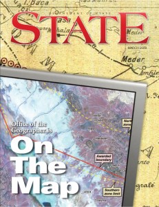
And for more information about the Office of the Geographer, see the article from State Magazine below:

RT @disruptivegeo: Note @mapbox @kelsosCorner: New high-res & generalized country polygons built from LSIB & WVS http://t.co/QJu …
@disruptivegeo @mapbox Wonderful news, thanks for your work on this 🙂
RT @disruptivegeo: Note @mapbox @kelsosCorner: New high-res & generalized country polygons built from LSIB & WVS http://t.co/QJu …
RT @disruptivegeo: Note @mapbox @kelsosCorner: New high-res & generalized country polygons built from LSIB & WVS http://t.co/QJu …
RT @disruptivegeo: Note @mapbox @kelsosCorner: New high-res & generalized country polygons built from LSIB & WVS http://t.co/QJu …
Awesome work by @StateDept HIU releasing high-res international boundary + shoreline data. http://t.co/SkJa4T7MMj via @disruptivegeo
RT @colemanm: Awesome work by @StateDept HIU releasing high-res international boundary + shoreline data. http://t.co/SkJa4T7MMj via @dis …
World Country Polygon Datasets http://t.co/Yw2LdW9HZC
Planet Geospatial: Disruptive Geo: World Country Polygon Datasets: The Humanitarian Information Unit (HIU) has… http://t.co/yAo99abvpo
RT: @GIS_Feed Planet #Geospatial: Disruptive Geo: World Country Polygon Datasets:Humanitarian Information Unit (HIU) http://t.co/ySFi2sPPKo
@disruptivegeo nice work!
FINALLY: US State Dept. Humanitarian Info Unit releases high-res world boundary datasets: http://t.co/YRlqWxrdIG Thx @disruptivegeo!
RT @schuyler: FINALLY: US State Dept. Humanitarian Info Unit releases high-res world boundary datasets: http://t.co/YRlqWxrdIG Thx @disr …
RT @schuyler: FINALLY: US State Dept. Humanitarian Info Unit releases high-res world boundary datasets: http://t.co/YRlqWxrdIG Thx @disr …
RT @schuyler: FINALLY: US State Dept. Humanitarian Info Unit releases high-res world boundary datasets: http://t.co/YRlqWxrdIG Thx @disr …
RT @schuyler: FINALLY: US State Dept. Humanitarian Info Unit releases high-res world boundary datasets: http://t.co/YRlqWxrdIG Thx @disr …
RT @schuyler: FINALLY: US State Dept. Humanitarian Info Unit releases high-res world boundary datasets: http://t.co/YRlqWxrdIG Thx @disr …
RT @schuyler: FINALLY: US State Dept. Humanitarian Info Unit releases high-res world boundary datasets: http://t.co/YRlqWxrdIG Thx @disr …
RT @schuyler: FINALLY: US State Dept. Humanitarian Info Unit releases high-res world boundary datasets: http://t.co/YRlqWxrdIG Thx @disr …
RT @schuyler: FINALLY: US State Dept. Humanitarian Info Unit releases high-res world boundary datasets: http://t.co/YRlqWxrdIG Thx @disr …
RT @schuyler: FINALLY: US State Dept. Humanitarian Info Unit releases high-res world boundary datasets: http://t.co/YRlqWxrdIG Thx @disr …
RT @disruptivegeo: Note @mapbox @kelsosCorner: New high-res & generalized country polygons built from LSIB & WVS http://t.co/QJu …
“World Country Polygon Datasets | Disruptive Geo” http://t.co/qwMzqtEHNd
RT @schuyler: FINALLY: US State Dept. Humanitarian Info Unit releases high-res world boundary datasets: http://t.co/YRlqWxrdIG Thx @disr …
RT @schuyler: FINALLY: US State Dept. Humanitarian Info Unit releases high-res world boundary datasets: http://t.co/YRlqWxrdIG Thx @disr …
RT @schuyler: FINALLY: US State Dept. Humanitarian Info Unit releases high-res world boundary datasets: http://t.co/YRlqWxrdIG Thx @disr …
Great stuff! World country polygon datasets, just released. http://t.co/xidi3BrbGf
RT @PetersonGIS: Great stuff! World country polygon datasets, just released. http://t.co/xidi3BrbGf
RT @PetersonGIS: Great stuff! World country polygon datasets, just released. http://t.co/xidi3BrbGf
RT @PetersonGIS: Great stuff! World country polygon datasets, just released. http://t.co/xidi3BrbGf
RT @PetersonGIS: Great stuff! World country polygon datasets, just released. http://t.co/xidi3BrbGf
RT @PetersonGIS: Great stuff! World country polygon datasets, just released. http://t.co/xidi3BrbGf
RT @PetersonGIS: Great stuff! World country polygon datasets, just released. http://t.co/xidi3BrbGf
RT @PetersonGIS: Great stuff! World country polygon datasets, just released. http://t.co/xidi3BrbGf
RT @PetersonGIS: Great stuff! World country polygon datasets, just released. http://t.co/xidi3BrbGf
RT @PetersonGIS: Great stuff! World country polygon datasets, just released. http://t.co/xidi3BrbGf
Interesting dataset but the Simplified World Polygons in KML format has Canada missing. I wouldn’t recommend this dataset until the problem is rectified.