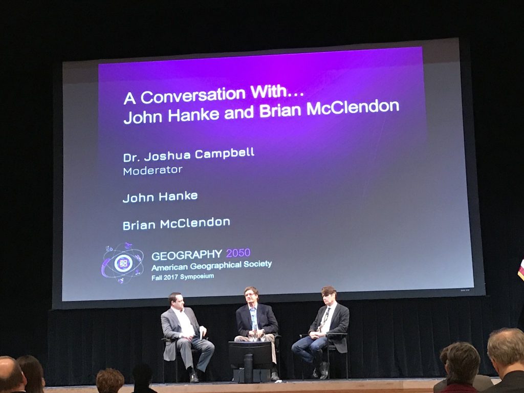
Every November the American Geographical Society holds its flagship Fall event, the Geography 2050 symposium. Designed to be a multi-year strategic dialog on the trends that will affect the planet in 2050, the theme for 2017 was the Geography 2050: The Future of Mobility.
In the Geography 2050 sequence, we envisioned the world of 2050, then focused on the inter-related topics of urban growth, sustainability, mobility, and next year will be energy. For each event we assemble a highly curated set of sessions and speakers that combine a geographic perspective with the academic, government, and business communities in a way that no other event replicates.
Background
In order to understand the roots of Geography 2050, and what we are trying to accomplish as the American Geographical Society (AGS), some backstory is needed. Starting four years ago, the AGS began a dramatic revitalization effort, one that would bring a significant influx of new energy, people, and ideas into the Society. Spearheaded by the now AGS Chairman, Dr. Chris Tucker, the idea of AGS 2.0 has taken root…with Geography 2050 one of its central concepts. This video, from the initial Geography 2050, describes the 2050 concept in more detail:
This synthesis is the hallmark of the AGS, and a differentiating factor in the discussions we facilitate. AGS history represents some of the best applications of the geographic perspective over the last 165 years, whether that be exploration, commerce, diplomacy, defense, or education. As we envision the role of AGS in the 21st century, we see a United States in need of greater geographic awareness. We see one role of AGS as a means to help foster a national dialogue on spatial literacy, and be a force for change in geographic education. These values are summed up well by AGS President Emeritus (and my Ph.D. advisor), Dr. Jerome Dobson, in this short video from the original Geography2050:
Highlights
The Future of Mobility event continued this trend, and the quality of sessions may have even exceeded previous years (kudos to the Dean Wise, AGS Councilor and the conference chair). It was hard not to leave the conference amazed at the pace of change in the mobility sector, and how close this next wave of technologies is to fundamentally changing how we are spatially organized. Videos for the sessions are being finalized now, and I’ll update when they are complete (see the Program here). Below are a few of my takeaways from the conference (and since I’m not an expert in mobility and transportation, I learned a tremendous amount from the sessions).
Clearly electric vehicles are already here, but when combined with longer battery life, increasing levels of automation, and “transport as a service” business models, the economics of automobile ownership and utilization change dramatically. The impact of this change on individual behavior and public planning for infrastructure leads to some widely divergent models that swing between transport utopia and massively underfunded public transportation. And this does not account for the potential of automated trucking and freight transport. We are already on the cusp of these changes, and even some of the best minds in transportation planning don’t really know what is going to happen in the next 10 years…let alone the 33 years till 2050.
Vertical take-off and landing (VTOL), flying cars, and other personal “jet pack” devices are becoming a reality. At this point, each of these are still piloted by humans, but clearly have the potential to become more and more autonomous (or remotely piloted). The already stressed regulatory environment for simply figuring out how to handle “beyond line of sight” human-flown drones, is going to be incredibly burdened as autonomous package delivery, flying taxi service, and personal VTOL devices become more common. The domestic and international airspace management regulations are incredibly complex, and accommodating these new forms of transport will be a generational challenge.
Hyperloop…wow…paradigm shift in the making. The potential of this technology is so absolutely incredible, it is truly difficult to appreciate the implications on human society. If we have any political will to accomplish great things left in this country, we should move as fast as possible towards Hyperloop. America’s bet on the automobile has been an incredible benefit to our society, and yet it has also locked us into a transport paradigm that is strangling our cities. From everything I saw, Hyperloop is the only technology that could fundamentally change the equation. The sheer speed that it travels will make disparate cities the same travel time away as current metro stops. To view some of the proposed Hyperloop routes and travel times between stops, check out the winners of the Global Route Challenge…with interactive maps.
Honoring Digital Cartography
On a personal level, this year was the first time that I’ve participated in Geography 2050 as an AGS Councilor (I spoke at the first event in 2014 before I joined the AGS Council). Having known and studied under Dr. Dobson since his arrival at the University of Kansas in 2001, I have been long steeped in AGS and its proud traditions. When Chris first proposed AGS 2.0, and started to invite new Councilors, I knew I wanted to be part of bringing new energy into the Society.
What I bring to AGS is an expertise in geographic information science and technology. Building on that background, my goal as a Councilor is to ensure AGS continues to be at the fore of geographic technology, and that the Society begin to formally recognize the contributions of those who are responsible for powering the “geospatial revolution”. Over the last 20 years geographic technologies have revolutionized our society (Global Positioning Systems, high resolution satellite imagery, in-car navigation, interactive web maps, etc…), and it is important that the Society formally acknowledge those in government, industry, and academia who contributed.
To that end, the 2017 edition of Geography 2050 marked the first attempt to do this. I believe there are many people who deserve to be honored for their contributions to the post-millennium explosion in digital geography, so nominating the right people had to be a mix of contributions and applicability to this year’s 2050 theme of mobility. Given that combination, it was clear that Brian McClendon and John Hanke were the right choices to nominate for the AGS O.M. Miller Cartographic Medal. I made the nomination, and the AGS Vice President and Chair of the Awards committee, Deborah Popper, wrote up two wonderful award letters that were read at the ceremony.
A Conversation with John Hanke and Brian McClendon

In addition to the award, both Brian and John were kind enough to participate in a Geography 2050 session, which was formatted as a conversation with them. It was an honor to moderate this session, a job that required I ask a couple opening questions and then get out of their way. I don’t get anxious speaking in front of crowds often, but have to admit, this one was a bit nerve-racking. But ultimately I think the session went well, and there was a lot of great feedback.
Update: Video of the session has been posted here and embedded below:
The goal of my questions was to first look back on their Keyhole / Google Earth experience, using it as a historical lens to view current trends. Then to discuss trends in autonomy and augmented reality that are affecting mobility. Co.Design (a Fast Company subsidiary) wrote an article on the session that has more detail.
I’d like to thank both of them personally for taking the time out of their schedules to come to New York to accept the AGS Miller Medal and participate in the panel. I certainly learned a lot, and feel that as AGS, we are off to a good start in honoring the pioneers of the modern digital geography movement.
If interested in additional information, Trajectory Magazine recently published an article on the history of Google Earth that provides great background on the evolution of the technology, and its role in the national security context.

